Seeing Vancouver Island’s giants is possible without deep-woods hiking, but it demands a shift from tourist to steward.
- Most accessible giants are reached via active or deactivated industrial roads, requiring specific vehicle preparation and navigation tools beyond Google Maps.
- The survival of these ancient ecosystems depends on visitors staying on designated paths to prevent irreversible damage to their shallow root systems.
Recommendation: Prioritize visiting established groves with boardwalks like Avatar Grove or Cathedral Grove. For more remote trees, use the Vancouver Island Backroad Mapbook and follow resource road safety protocols to the letter.
The desire to stand in the presence of a living giant, a tree that has witnessed centuries, is a powerful calling. For many nature lovers, the legendary old-growth forests of Vancouver Island, epitomized by places like Cathedral Grove, represent the pinnacle of this experience. However, the common perception is that these titans are reserved for the most intrepid backcountry hikers, those capable of navigating treacherous, unmaintained trails deep in the wilderness. This creates a barrier for individuals with mobility challenges, families with young children, or simply those who prefer exploration by vehicle.
This guide starts from a different premise. As a forest ecologist and accessibility advocate, I argue that the real challenge isn’t physical endurance, but mindful preparation. Accessing these ancient sentinels by car is not only possible but offers a unique perspective on the island’s delicate balance between industry and conservation. We will move beyond the typical tourist trails to understand the “why” behind the rules—why stepping off a boardwalk can be a death sentence for a 1,000-year-old tree and why your GPS is not your friend in the bush. This is not just a map to big trees; it’s a guide to becoming a temporary guardian of the ecosystems you wish to admire.
Throughout this article, we’ll explore the practicalities of navigating the island’s unique road networks, the gear that makes a wet-coast winter trip enjoyable, and the specific ways you can experience these forests without causing harm. By understanding the ecology of these giants, you can transform a simple sightseeing trip into a meaningful act of conservation.
For those who prefer a visual introduction, the following video offers a powerful glimpse into the scale and solitary majesty of Big Lonely Doug, a tree that has become a symbol for old-growth preservation across Canada.
This guide is structured to equip you with both the practical knowledge and the ecological awareness needed for a safe and respectful visit. From identifying the different types of giants to understanding the best time to capture their beauty, each section builds on the last to provide a comprehensive framework for your adventure.
Summary: A Guide to Accessing Vancouver Island’s Old-Growth Forests
- Big Lonely Doug: How to Navigate Logging Roads to Find Canada’s Most Famous Tree?
- The Boardwalk Rule: Why Stepping Off the Path Kills Ancient Trees?
- Douglas Fir vs. Cedar: How to Identify the Giants of the Pacific Northwest?
- Golden Hour in the Rainforest: When is the Best Light for Forest Photography?
- Gaiters and Gore-Tex: How to Hike the West Coast Rainforest Without Getting Soaked?
- GPS or Topo Maps: What to Trust When You Are 50 km into the Bush?
- October to March: Is it Worth Visiting Tofino During Storm Watching Season?
- How to Kayak the Pacific Ocean Safely If You Have Only Paddled Lakes?
Big Lonely Doug: How to Navigate Logging Roads to Find Canada’s Most Famous Tree?
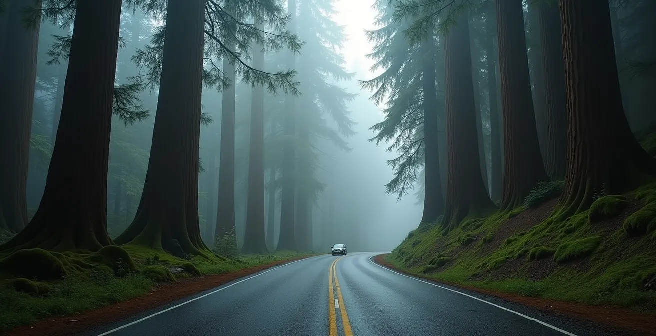
Reaching Big Lonely Doug is not a typical Sunday drive; it’s an expedition into the heart of British Columbia’s industrial forest landscape. The journey itself is a lesson in the complex reality of conservation. The tree was famously saved in 2011 by logger Dennis Cronin, who marked it as a “Leave Tree” amidst a planned clearcut. This single act of foresight preserved Canada’s second-largest Douglas fir, which now stands as a solitary monument in a 20-hectare clearcut, a poignant symbol of what was lost and what remains.
The primary challenge is navigating the network of active and inactive resource roads. These are not public highways; they are industrial arteries. Safety is paramount and non-negotiable. Industrial traffic, particularly massive logging trucks, has the absolute right-of-way. Your role as a visitor is to be invisible and predictable. This means driving with headlights on at all times for visibility in the dust, knowing the standardized radio channels to call out your position, and being prepared to pull over or even reverse to the nearest turnout without hesitation.
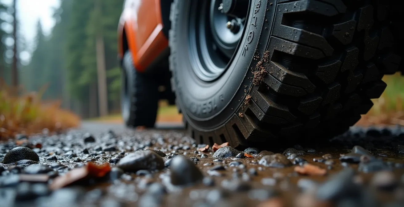
Vehicle preparation is as crucial as navigational skill. Roads can be rough, muddy, and covered in sharp gravel. A reliable vehicle with good ground clearance and, most importantly, heavy-duty 10-ply tires is highly recommended. A full-sized spare tire, along with the knowledge and tools to change it, is not an option but a necessity. Cell service is non-existent, so you are entirely self-reliant. The journey to see this giant is a powerful experience, but it requires accepting the responsibilities that come with entering a working industrial environment.
Your Action Plan: BC Forest Service Road Safety Protocol
- Program Resource Road Radio Channels (RR 1-40) at a local mobile radio shop before departure; these are standardized province-wide.
- Call out your kilometer markers every 2km on active roads, announcing ‘loaded’ or ’empty’ and your direction of travel.
- Drive with headlights on at all times, even during daylight hours, to cut through dust.
- Yield immediately to all industrial traffic. Pull over, back up if necessary, and make eye contact with truck drivers to confirm they see you.
- Wait for dust from passing vehicles to settle completely before proceeding, as visibility can drop to zero.
The Boardwalk Rule: Why Stepping Off the Path Kills Ancient Trees?
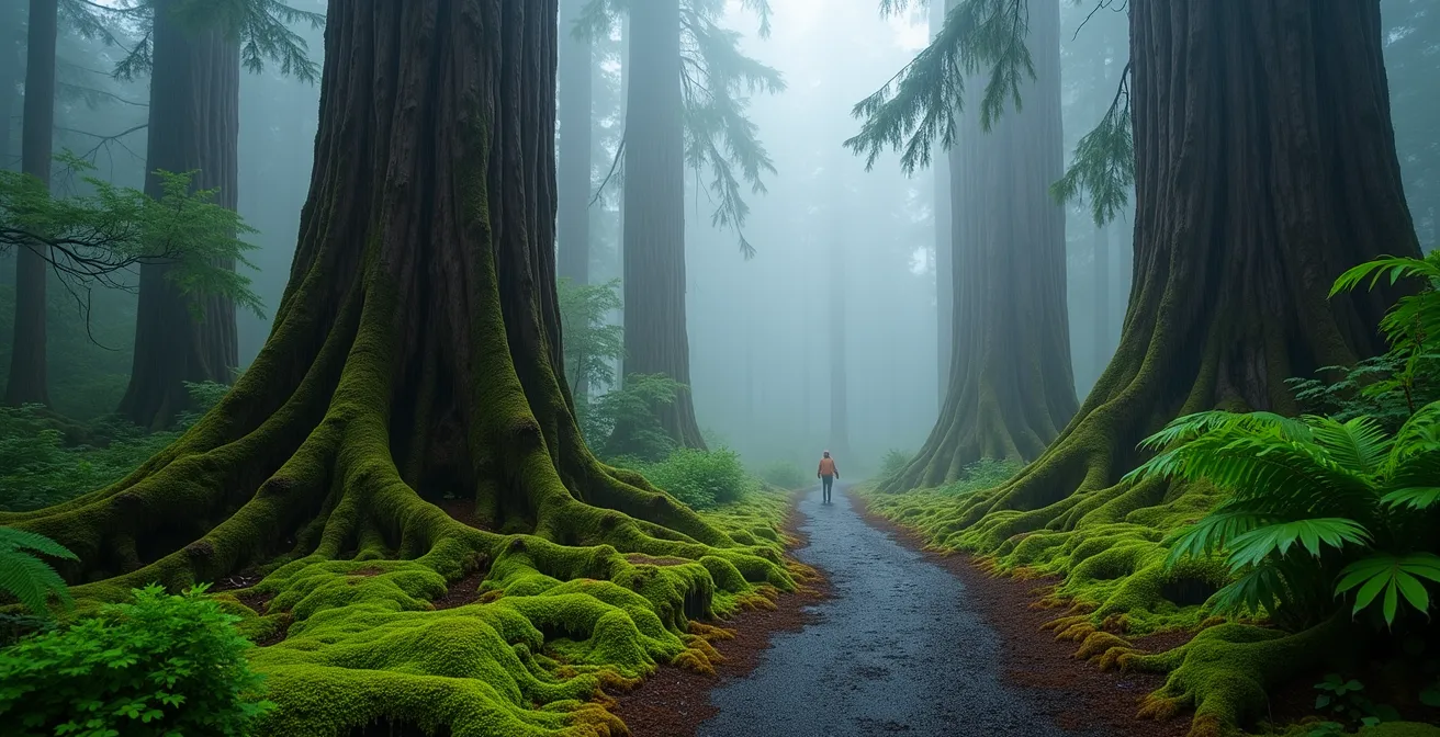
The single most important rule when visiting an old-growth grove is simple: stay on the designated path or boardwalk. This isn’t about crowd control; it’s a matter of life and death for the very trees you’ve come to admire. The immense size of a Western Red Cedar or Douglas Fir is deceptive. Their root systems are surprisingly shallow, spreading out like a wide, delicate plate just beneath the forest floor rather than plunging deep into the earth. Every footstep off the trail compacts the soil, crushing the fine, hair-like roots responsible for absorbing water and nutrients.
This damage is compounded by the disruption of a vast, hidden network. Recent research from the University of British Columbia confirms that virtually 100% of old-growth trees are interconnected through what are known as mycorrhizal networks. This “wood-wide web” is a symbiotic relationship between tree roots and fungi, allowing trees to share resources, send stress signals, and transfer carbon. As pioneering ecologist Dr. Suzanne Simard explains, these networks are fundamental to the forest’s health.
Common mycorrhizal networks are networks of mycorrhizal fungal hyphae held in common by at least two plants… investigating underground transmission of carbon between ectomycorrhizal paper birch and Douglas-fir as well as arbuscular mycorrhizal western redcedar trees in the mixed temperate rainforests of western Canada
– Dr. Suzanne Simard, Frontiers in Forests and Global Change
When you step off the path, you are not just compacting soil around one tree; you are severing these critical underground connections. The success of the volunteer-built boardwalk in Avatar Grove is a testament to this principle. Before its installation, the area was suffering from severe erosion and root damage due to heavy foot traffic. The boardwalk, constructed by the Ancient Forest Alliance, successfully mitigated this impact, preserving the grove for future generations. Respecting the path is the most profound act of reciprocity you can offer these ancient beings—a small gesture that ensures their survival.
Douglas Fir vs. Cedar: How to Identify the Giants of the Pacific Northwest?
Standing in a Pacific Northwest rainforest, you are surrounded by giants. But which is which? The two dominant titans of Vancouver Island’s old-growth ecosystems are the Douglas Fir (Pseudotsuga menziesii) and the Western Red Cedar (Thuja plicata). Learning to distinguish them deepens your appreciation for the forest’s diversity and the specific roles each tree plays. While both can reach staggering heights, they have distinct characteristics shaped by their preferred environments.
The Douglas Fir is a tree of sun and fire. It’s often a pioneer species, colonizing areas after a disturbance. You’ll typically find it on drier, sunnier slopes. Its bark is its most telling feature: thick, deeply furrowed with prominent ridges, acting as a shield against fire. Crush its needles, and you’ll get a sharp, almost citrusy scent. The world’s largest Douglas-fir, the Red Creek Fir, is located on Vancouver Island and measures an incredible 73.8 meters (242 feet) tall.
The Western Red Cedar, by contrast, is a tree of water and shade. It thrives in wet, mossy valley bottoms and swampy areas. Its bark is completely different: thin, fibrous, and peeling off in long, stringy strips. Its foliage is composed of flat, scale-like leaves that release a sweet, aromatic fragrance when bruised. For many Coastal First Nations, it is revered as the ‘Tree of Life’ for its versatile wood and bark. One of the largest cedars in Canada, found in Ahousaht territory, is estimated to be five metres wide at its base.
This table summarizes the key differences, providing a quick field guide for your next forest walk. Recognizing these features will transform your view from a general sea of green to a community of distinct, individual giants.
| Feature | Douglas Fir | Western Red Cedar |
|---|---|---|
| Maximum Height | 80-90 meters | 60-70 meters |
| Bark Pattern | Deeply furrowed, thick ridges | Fibrous, stringy strips |
| Needle Scent | Sharp, citrusy when crushed | Sweet, aromatic fragrance |
| Preferred Habitat | Drier, sunnier slopes | Wet, mossy valley bottoms |
| Wildlife Use | Canopy for birds | Bear denning in hollow trunks |
| Cultural Significance | Pioneer after fires | ‘Tree of Life’ for Coastal First Nations |
Golden Hour in the Rainforest: When is the Best Light for Forest Photography?
Photographing the giants of Vancouver Island presents a unique challenge. The classic “golden hour” light, so coveted by landscape photographers, rarely penetrates the dense, multi-layered canopy of a temperate rainforest. Instead of fighting for elusive sunbeams, the key to successful forest photography is to embrace the region’s characteristic weather. The west coast of Vancouver Island’s status as one of the wettest parts of Canada is actually an advantage for photographers.
The best light is often found on overcast, cloudy days. This ‘overcast advantage’ provides a giant, natural softbox, creating flat, diffused light that eliminates harsh shadows and allows the rich, saturated greens of moss and ferns to pop. This is the true color palette of the rainforest. The rain itself is an asset, adding a glossy sheen to leaves and darkening tree bark to create mood and contrast. A circular polarizing filter is an essential tool, helping to cut glare on wet surfaces and deepen the colors even further.
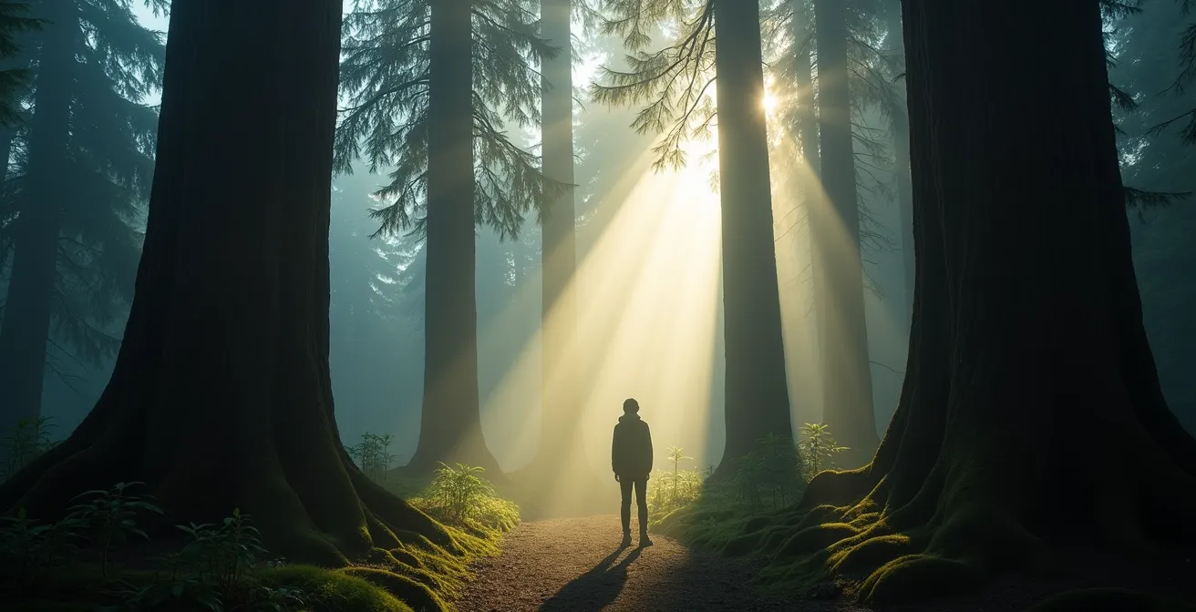
The most magical moments, however, often occur when light does break through. Following a rain shower or during early morning, mist and fog can hang in the air, creating the perfect conditions for crepuscular rays, or ‘God-rays’. These dramatic shafts of light cutting through the canopy are a signature Vancouver Island phenomenon, transforming the forest into a natural cathedral. To capture them, you must be patient and position yourself to shoot into the light. Compositionally, look beyond just pointing your camera up at the tall trees. Use the lush understory—ferns, fallen logs, and mossy roots—as foreground elements to create depth and a sense of immersion. Including a person in the frame can also be incredibly effective for conveying the sheer scale of these ancient trees.
Gaiters and Gore-Tex: How to Hike the West Coast Rainforest Without Getting Soaked?
There’s no such thing as bad weather on Vancouver Island, only inappropriate clothing. The key to comfortably exploring the rainforest, especially outside the brief summer season, is a strategic layering system designed to handle persistent moisture. Forget the light rain jacket you use in the city; the West Coast demands gear rated for intense, multi-day rainfall events. Environment Canada regularly issues weather alerts for heavy rain from late fall through spring, driven by powerful “atmospheric rivers” that can saturate everything in hours.
Your defense starts with a high-quality base layer, ideally made of Merino wool. Unlike cotton, which loses its insulating properties when wet, wool stays warm even when damp from sweat or ambient humidity. The next critical piece is your outer shell. A jacket and pants made from Gore-Tex or an equivalent waterproof/breathable membrane are essential. This technology allows sweat vapor to escape while blocking incoming rain, preventing the clammy feeling of being soaked from the inside out.
Two often-overlooked items are crucial for true West Coast comfort: waterproof boots and gaiters. The trails are perpetually muddy and often involve crossing small streams. Waterproof rubber boots (or high-quality waterproof hiking boots) are non-negotiable. Gaiters, which are waterproof sleeves that cover the top of your boots and your lower legs, provide a dual benefit. They create a seal that prevents water from running down your pants into your boots and offer protection from “salal-scratch”—the constant scraping from the ubiquitous, tough-leafed undergrowth. Finally, the most important piece of gear might be what you leave in your car. A dry bag containing a complete change of clothes, a towel, and dry shoes makes the drive back to your accommodation infinitely more comfortable after a day of soaking in the forest’s beauty.
Your Checklist: Essential Vancouver Island Rain Gear
- Base Layer: Merino wool top and bottoms that insulate even when damp.
- Shell Layer: A high-quality Gore-Tex (or equivalent) waterproof and breathable jacket rated for heavy, sustained rain.
- Lower Body: Waterproof rain pants combined with gaiters for dual protection against rain and undergrowth.
- Footwear: Fully waterproof rubber or hiking boots suitable for deep mud and stream crossings.
- Post-Hike Car Kit: A dry bag with a complete change of clothes, a towel, and comfortable dry shoes for the ride home.
GPS or Topo Maps: What to Trust When You Are 50 km into the Bush?
In the Vancouver Island backcountry, your smartphone’s GPS is not just unreliable; it can be dangerously misleading. While indispensable in the city, apps like Google Maps do not differentiate between maintained public roads, active industrial resource roads, and, most perilously, deactivated roads. The provincial government notes that resource roads may be deactivated when no longer needed, meaning bridges can be removed and roadbeds can be impassable, even though they still appear on digital maps. Trusting turn-by-turn directions from a consumer GPS app can easily lead you to a dead-end or a washed-out bridge, miles from cell service.
The gold standard for navigating the island’s vast network of logging roads is a physical map. Specifically, the most recent edition of the Vancouver Island Backroad Mapbook. This resource is meticulously updated and trusted by locals, loggers, and emergency services. It details the status of roads, marks recreational sites, and provides topographical information that is crucial for understanding the landscape. Your primary navigation should always be done with this mapbook.
This doesn’t mean technology has no place. A GPS app like Gaia GPS is an excellent secondary tool, but its role should be to pinpoint your current location on the physical map, not to dictate your route. Before leaving cell service, always pre-download offline maps for the entire area you plan to explore. This ensures your GPS can still get a satellite fix and show your location even without a data connection. Ultimately, the safest approach combines the best of both worlds: the trusted accuracy of a paper mapbook for routing and the real-time location data of a GPS for confirmation. And always, as a final backup, trust your compass and leave a detailed trip plan with someone before you depart.
Your Navigation Toolkit: Essentials for the Vancouver Island Backcountry
- Primary Tool: The most recent edition of the Vancouver Island Backroad Mapbook is the local gold standard.
- GPS Apps: Use Gaia GPS or a similar app to find your current location on the paper map, not for routing.
- Pre-Download Maps: Always download offline maps of your entire route before you lose cell service.
- Topographic Reading: Learn to identify “benches” (flatter areas) and valley bottoms on your map, where old-growth is most likely to thrive.
- Backup Plan: Carry a compass, know how to use it, and always leave a detailed trip plan with a reliable contact.
October to March: Is it Worth Visiting Tofino During Storm Watching Season?
While summer brings crowds to Tofino and the Pacific Rim, the off-season from October to March offers a completely different, and arguably more profound, experience of the coastal rainforest. This is storm watching season, a time when the Pacific Ocean unleashes its raw power against the shoreline. For the forest explorer, this translates to a world transformed by rain, mist, and a unique, moody atmosphere that is absent in the drier summer months.
Visiting during this period requires flexibility and a healthy respect for the weather. Travelers should expect potential closures and delays on Highway 4, the main artery to the west coast, especially during major storms. However, the rewards for those who make the journey are immense. The forest comes alive in the rain. Mosses and lichens become explosively vibrant, glowing with an almost neon green. The forest floor erupts with a staggering diversity of fungi, and the air is thick with the smell of damp earth and cedar.
This off-season tourism is also a vital part of the local economy’s shift towards conservation. Towns like Port Renfrew, once dependent on logging, now thrive as “Canada’s Tall Tree Capital” by attracting visitors year-round to its protected ancient forests, such as Avatar Grove. The winter season allows for a more intimate and less crowded experience of these magnificent groves. With the right waterproof gear, a walk through an old-growth forest during a winter storm is not something to be endured, but to be savored. It’s an opportunity to witness the resilience of these ancient ecosystems and feel the powerful forces that have shaped them for millennia.
Key takeaways
- Accessible old-growth viewing requires shifting from a “tourist” to a “steward” mindset, prioritizing forest health over convenience.
- Navigating to remote giants depends on physical Backroad Mapbooks and resource road safety protocols, not consumer GPS.
- The survival of these ancient trees relies on visitors strictly adhering to boardwalks and designated paths to protect their fragile, shallow root networks.
How to Kayak the Pacific Ocean Safely If You Have Only Paddled Lakes?
For those willing to trade four wheels for a paddle, kayaking opens up a whole new dimension of old-growth exploration on Vancouver Island. It provides access to pristine coastal groves in places like Clayoquot and Barkley Sound that are completely unreachable by car. However, the transition from calm lake paddling to the dynamic Pacific Ocean is significant and requires new skills and a deep respect for the marine environment.
The two biggest factors to master are tides and temperature. Unlike a lake, the ocean is in constant motion. A 4-knot current in a narrow channel near Tofino is impossible to paddle against, meaning your entire trip must be planned around the tide charts. Local apps and tide tables are essential tools for timing your passages. Even more critical is cold water protection. The Pacific Ocean is dangerously cold year-round. A wetsuit or drysuit is mandatory. The “1-10-1 Rule” is a sobering reminder of the stakes: upon immersion in cold water, you have 1 minute to control your breathing, 10 minutes of meaningful movement, and 1 hour before unconsciousness from hypothermia. Your gear is your lifeline.
The safest and most enriching way to make this transition is to book a trip with a certified local guide from Tofino or Ucluelet. Their knowledge of secret spots, weather patterns, and First Nations history is invaluable. They can guide you to places like the Meares Island Big Tree Trail. This Tribal Park, protected from logging by the Tla-o-qui-aht and Ahousaht First Nations, is home to some of BC’s oldest trees and is accessible only by water. Paddling to the trailhead and walking among thousand-year-old cedars is an experience that truly connects the forest to the sea, offering a perspective on the coastal ecosystem that is simply unforgettable.
Ultimately, experiencing Vancouver Island’s giants is an act of partnership. By equipping yourself with the right knowledge, the right gear, and the right mindset, you can step into their world not as a conqueror, but as a respectful guest, ensuring these magnificent forests continue to inspire awe for generations to come.